
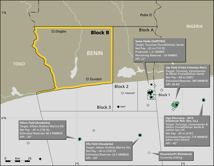
he Bénin Block B is located in an area with an already proven hydrocarbon system, being the onshore extent of the prolific West African Transform Margin. No oil exploration well has ever been drilled on shore Benin or Togo. Oil fields are known from shallow water off the coast of Togo, Benin and western Nigeria, with the oil source kitchen lying immediately to south, in deeper water. However, it is established that oil has migrated further northwards and onshore, by virtue of the presence of oil and gas seeps in water wells in the Block B area, and still further to the north and east, by the Mamu Tar Sands. The rocks present in the subsurface of Block B reach the surface to the north and west. There, it is possible to see thick fluvio-deltaic sandstones of presumed Turonian age, overlain by thick red fluvio-lacustrine mudstones. Thus, all the components for a robust petroleum play are present in Block B.
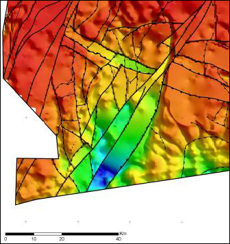 |
Prospects and Leads Following the acquisition of the AGG (Aero Gravity Graviometry) survey and reprocessing of existing 2D seismic data certain prospects were defined and new leads were identified in the Bénin Block B. The main exploration focus currently lies in the centre of the block, where a number of robust and large structures are evident. The Allada structure, identified on legacy 2D seismic, is the largest of these. It is not clear at this stage how much new 2D seismic will be necessary to define drilling targets for the next contract stage. |